


Zelalem Demissie Ph.D.
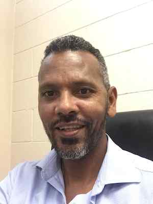
Zelalem Demissie Ph.D.
Assistant Professor
Department of Geology · Fairmount College of Liberal Arts and Sciences
Geology Building 217
Main Campus
Campus Box 27
Overview
Ph.D. – Geology – Oklahoma State University (2018)
M.S. – Geology and Geophysics – Addis Ababa University (2005)
B.S. – Geology and Geophysics – Addis Ababa University (2000)
Dr. Zelalem Demissie is an Associate Professor of Environmental Geoscience whose research integrates geospatial science, GIS, remote sensing, geophysics, geodesy, GeoAI, and machine learning to investigate Earth system processes. His work focuses on critical mineral exploration, natural hazards, groundwater resources, crustal deformation using InSAR and GNSS, geothermal systems, and environmental monitoring. By combining advanced geospatial technologies with data-driven modeling, he develops innovative solutions that support natural resource management, hazard mitigation, and sustainable environmental decision-making.
Academic Interests and Expertise
My expertise spans geospatial science, geophysics, geodesy, remote sensing, and geographic information systems (GIS), with emphasis on integrating satellite observations, field measurements, and computational methods to investigate Earth system processes. I develop and apply geospatial artificial intelligence (GeoAI), machine learning, and spatial analytics to address challenges related to natural hazards, water resources, environmental sustainability, critical infrastructure, and Earth surface dynamics.
Areas of Research Interest
- Geospatial Science and Geographic Information Systems (GIS)
- Remote Sensing and Earth Observation
- Geospatial Artificial Intelligence (GeoAI)
- Machine Learning for Earth and Environmental Sciences
- Interferometric Synthetic Aperture Radar (InSAR)
- Global Navigation Satellite Systems (GNSS)
- Geophysics and Geodesy
- Active Tectonics and Crustal Deformation
- Earthquake and Volcanic Hazard Assessment
- Flood Susceptibility and Flood Risk Modeling
- Drought Monitoring and Prediction
- Groundwater Exploration and Hydrogeophysics
- Geothermal Resource Assessment
- Environmental Monitoring and Change Detection
- Digital Elevation Model (DEM) Analysis
- Spatial Statistics and Environmental Modeling
- Multi-source Geospatial Data Integration
Areas of Teaching Interest
I teach undergraduate and graduate courses in geoscience, geospatial science, and environmental geoscience, with an emphasis on integrating theory, field applications, and computational methods. My teaching interests include:
- Applied Geographic Information Systems (GIS) (GEOL 690Z)
- Spatial SQL and Spatial Database Engine (SDE) (GEOL 692)
- Python for Geospatial Applications (GEOL 693)
- Remote Sensing Interpretation (GEOL 564)
- Issues in Global Environmental Science (EEPS 721)
- Introduction to Environmental Geology (GEOL 102)
- General Geology (GEOL 111)
- Structural Geology
- Geophysics
- Geodesy
- Geomorphology
- Geospatial Data Science
- Geospatial Artificial Intelligence (GeoAI)
- Machine Learning for Geosciences
- Environmental Modeling
- Natural Hazards and Risk Assessment
- Earth and Environmental Data Analytics
Publications
Publications
2026
- Anteneh, A., Alemu, A., Getaneh, W., Demissie, Z., & Abdulkadir, S. (2026). 3D Magnetic Inversion and Radiometric Studies for the Delineation and Characterization of Litho-Structural Features Hosting Gold and Associated Mineralization: A Case Study. Journal of African Earth Sciences.
- Wassihun, S., Nigussie, W., Mickus, K., Workie, M. D., Alemu, A., Demissie, Z., et al. (2026). Volcano-Tectonic Features of the Northwestern Ethiopian Plateau: Implications for the Origin of the Lake Tana Basin. Journal of Geodynamics.
- Moges, G., Alemu, A., Demissie, Z., Ejepu, J., & Chepigo, L. (2026). Groundwater-Oriented Subsurface Imaging via Joint 2D/3D Gravity and Magnetic Modeling Constrained by VES and Geological Data in the Aluto-Langano Area, Ziway-Abijata and Langano Lakes Corridor. Journal of African Earth Sciences.
- Bewketu, K., Alemu, A., Mickus, K., Demissie, Z., & Papadopoulos, N. (2026). Mapping Subsurface Lineaments beneath the Ethiopian Plateaus and the Adjoining Ethiopian Rifts Using Gravity Data: Implications for Tectonic Evolution of the Underlying Crust. Results in Earth Sciences.
2025
- Oseyemi, F., Seyoum, W. M., Gebremichael, E., Awuku, J., & Demissie, Z. (2025). Predictive Hydrogeological Modeling of Lake Beseka’s Expansion Driven by Anthropogenic Activities Using MODFLOW-USG. AGU Fall Meeting Abstracts.
- Emishaw, L., Katumwehe, A., Leseane, K., Demissie, Z., Mickus, K., & Abdelsalam, M. (2025). The Legacy of the East African Rift System in Understanding Continental Rifts Worldwide from Geophysical Studies (with Emphasis on Gravity and Magnetic Studies). Journal of African Earth Sciences.
2024
- Demissie, Z., Rimal, P., Seyoum, W. M., Dutta, A., & Rimmington, G. (2024). Flood Susceptibility Mapping: Integrating Machine Learning and GIS for Enhanced Risk Assessment. Applied Computing and Geosciences.
- Kebede, H., Demissie, Z., Tadesse, H., & Eshetu, A. (2024). Spatial Interpolation Techniques Comparison and Evaluation: The Case of Ground-Based Gravity and Elevation Datasets of the Central Main Ethiopian Rift. Heliyon.
2023
- Bedassa, G., Ayalew, D., Getaneh, W., Fontijn, K., Emishaw, L., Melaku, A. A., Tadesse, A. Z., Demissie, Z., Swindle, A., & Chamberlain, K. J. (2023). Stratigraphy and Eruptive History of Gedemsa Caldera Volcano, Central Main Ethiopian Rift. Journal of Volcanology and Geothermal Research.
- Abebe, E., Kebede, H., Mickus, K., & Demissie, Z. (2023). Earthquake Magnitude Prediction Using Deep Learning for the Horn of Africa. Soil Dynamics and Earthquake Engineering.
- Nigussie, W., Alemu, A., Mickus, K., Keir, D., Demissie, Z., Muhabaw, Y., Muluneh, A. A., Corti, G., & Yehualaw, E. (2023). Subsurface Structural Control of Geothermal Resources in a Magmatic Rift: Gravity and Magnetic Study of the Tulu Moye Geothermal Prospect, Main Ethiopian Rift. Frontiers in Earth Science.
- Nigussie, W., Mickus, K., Keir, D., Alemu, A., Muhabaw, Y., Muluneh, A. A., Yehualaw, E., & Demissie, Z. (2023). Subsurface Structure of Magmatic Segments During Continental Breakup: Perspectives from Gravity Data Analysis Along the Main Ethiopian Rift. Frontiers in Earth Science.
- Demissie, Z., Bedassa, G., Rattani, A., Nigussie, W., Kebede, H., Muhabaw, Y., & Haridasan, S. (2023). The Significance of Volcanic Segments and Rifts in Fault Characterization Within the Amagmatic Graben of the Afar Depression, Ethiopia. Journal of Structural Geology.
2022
- Demissie, Z., & Rimmington, G. (2022). Surface Displacement Mechanisms of the Dobi Graben from ASAR InSAR Time-Series Analysis: Implications for the Tectonic Setting of the Central Afar Depression. Remote Sensing.
2020
- Demissie, Z., & Davila, D. L. (2020). 3D Displacement Maps of the 2019–2020 Puerto Rico Earthquake Sequence from DInSAR and MAI and Comparison with Mapped On-Land Faults. Seismological Research Letters.
2018
- Demissie, Z., Mickus, K., Bridges, D., Abdelsalam, M. G., & Atekwana, E. A. (2018). Upper Lithospheric Structure of the Dobi Graben, Afar Depression, from Magnetic and Gravity Data. Journal of African Earth Sciences.
- Google Scholar: https://scholar.google.com/citations?user=4EwMCLwAAAAJ&hl=en
- ORCID: https://orcid.org/0000-0001-9917-0234
Professional Experience
Wichita State University (WSU)
Assistant Professor– Wichita, KS August 2019 – Present
The World Bank Group
Geospatial and GIS Consultant – Washington DC | January 2016 – June 2016
- Utilized ArcGIS SDE and Spatial Modeler to map and identified road network expansion impact from 1998 to 2012 on the commodities exchanges and influences on price fluctuations.
Documented the stock of roads into asphalt, gravel and dirt roads as interpreted from higher spatial resolution Satellite Panchromatic imageries of the Digital Globe satellite and created infrastructure geo-meta-database for 640 districts in Ethiopia. - Provided Geospatial Services to extract terrain and/or feature data through photogrammetric engineering methods utilizing stereo and/or mono image sources.
- Provided support in geospatial analysis of cartographic products, georeferencing of cartographic products and imagery analysis.
Oklahoma State University, Department of Geography, Cartography Services
Cartographic Technician Intern – Stillwater, Ok | June 2014 – August 2014
- Renovated the analogue format of the mid-continent geological maps, profile sections and stratigraphic columns into digital format.
Kent State University
Research Assistant & Teaching Assistant – Kent, OH | August 2009 – May 2010
- Taught Earth Dynamics and Earth History courses laboratory experiment courses. The Geodynamics and Earth History lab sessions using crystals and common and unusual rock specimens. The Earth Dynamics Laboratory course is designed to acquainted students with diverse Earth materials including minerals, rocks, and groundwater. Assisted students on how to work with various types of maps commonly used in geology
- Measured fracture data and analyzing the regional and local patterns in order to characterize the hydraulic conductivities of the Marcelles Shale Formation in Northeastern Ohio.
Geo-Spatial Information Solutions Inc.
Co-founder and General manager – Addis Ababa, Ethiopia | April 2005 – August 2009
- Planned, managed and implemented the ‘Detailed spatial guide map of the capital City of Ethiopia, Addis Ababa’.
- Supervised and updated a geospatial guide map and GPS navigation system for Addis Ababa.
Conducted various geo-spatial 3D model using ArcGIS for various feasibility studies including ground-water occurrence, dimension stone mining, exploration and exploitations - Utilized ArcGIS software tools, such as spatial analyst, network analyst, and 3D analyst, to perform topology corrections for geophysical studies, drilling site selection, pipelines, wells, platforms, terminals, city water refineries.
- Analyzed various project-specific maps and associated databases to assist decision makers in visualizing their full projects and ease further implementation.
- Provided remote sensing (optical and radar signal processing and interpretation) and Geographical Information Science (GIS) training for geologists, engineers, and upper-echelon management at the National Mining Corporation, the Ethiopian Geological Survey, the Federal Republic of Ethiopia Disaster Preparedness and Preventions Institute, and the Ethiopian Water Well Design and Supervision Enterprise.
National Mining, Inc.
Project Geologist – Addis Ababa, Ethiopia | September 2001 – April 2005
- Catalogued and curated physical (drill core, dredge, sediments, fluids, synthetic cements, thin sections) and digital (geochemical, microbiologic, SEM, XRD, CT scans) geo-samples. Quantified total volume of the project physical and digital geo-samples for the precious metals (Gold) resources exploration.
- Prepared the DTM and 3D subsurface model of the project area for subsequent geophysical exploration and drilling site selection. Utilized Data mined spatial datasets and validation maps on a project scale that pertained to drilling.
- Compiled vector shapefiles in a structured geodatabase using ArcGIS and Python. Multiple iterations of quality assurance and multi- variate analyses to assess data gaps and reduce uncertainty.
- Developed a central Geospatial database for voluminous precious metals exploration data of the National Mining Inc. collected over 10 years.
Additional Information
The Geospatial and Geodynamics Lab at Geology Department at Wichita State University have the following hardware and software:
- Four high-performance workstations and other high processing computers
- One 42″ plotter
- One-color printer
- One black and white printer
- One 12″ scanner
- OASIS Montaj-Geosoft for subsurface lithospheric structure modeling and analysis
- 2D and 3D GEM SYS forward modeling inversion module for Gravity, magnetics and electrical resistivity potential data
- L3HARRIS Geospatial: Environment for Visualizing Images (ENVI) 5.5.3 software for digital image processing of remotely sensing data including:
Optical imagery pixel tracking module
Multi-Spectral and hyperspectral mapping module
LIDAR: DSM cloud points module
SARscape: Radar Interferometry module (InSAR)
Deep Learning module for fast and accurate automotive analytics results
Photogrammetry module: DSM cloud points generation from stereo images
- ESRI ArcGIS 10.7 and ArcGIS pro 2.4 software to produce vector-based map production, spatial analysis, Geospatial database, all geoprocessing module extension, web map sharing and to generate story map
- SNAP Sentinel-1 toolbox (S1TBX), Sentinel-2 toolbox (S2TBX), Sentinel-3 toolbox (S3TBX)
- GoogleEarth Pro
- Adobe Web Premium
- Microsoft Office and Outlook